

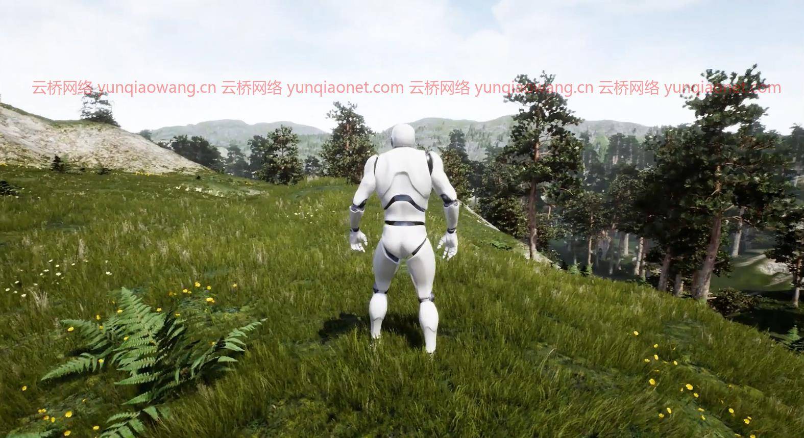
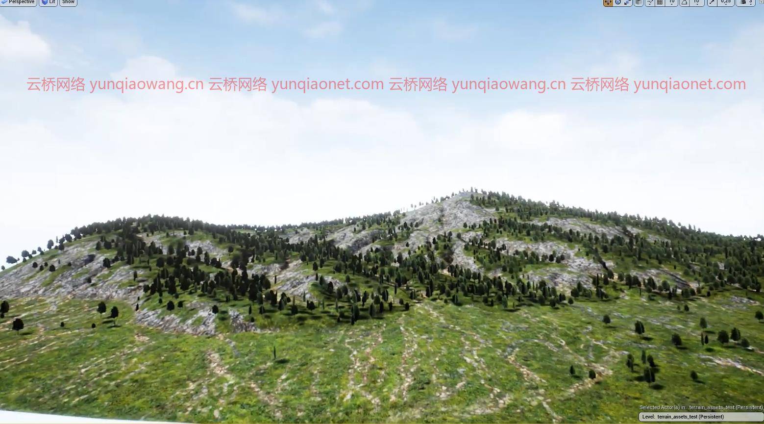
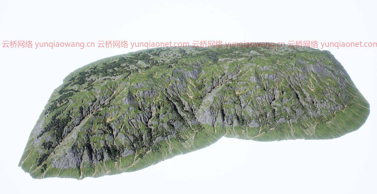
在这个在线课程中,观看者将在第一个教程的工作流程的基础上,学习使用胡迪尼生成更复杂的地形和景观的先进技术,并在虚幻引擎4等游戏引擎中使用它们。
我们将主要关注如何导入和处理卫星地形数据,以:
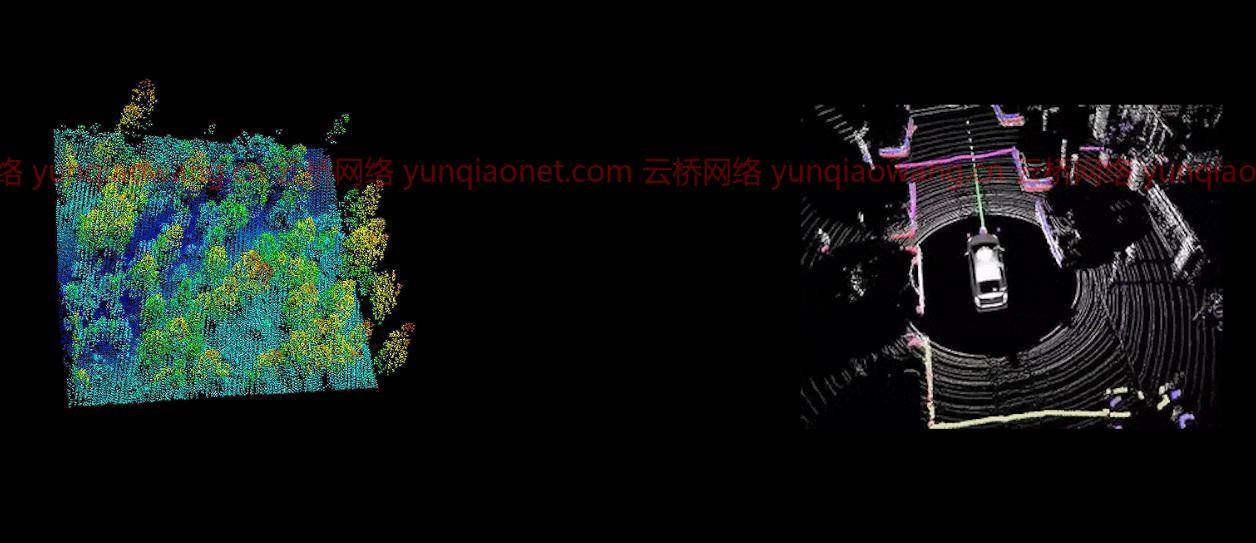
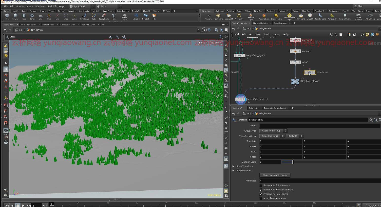
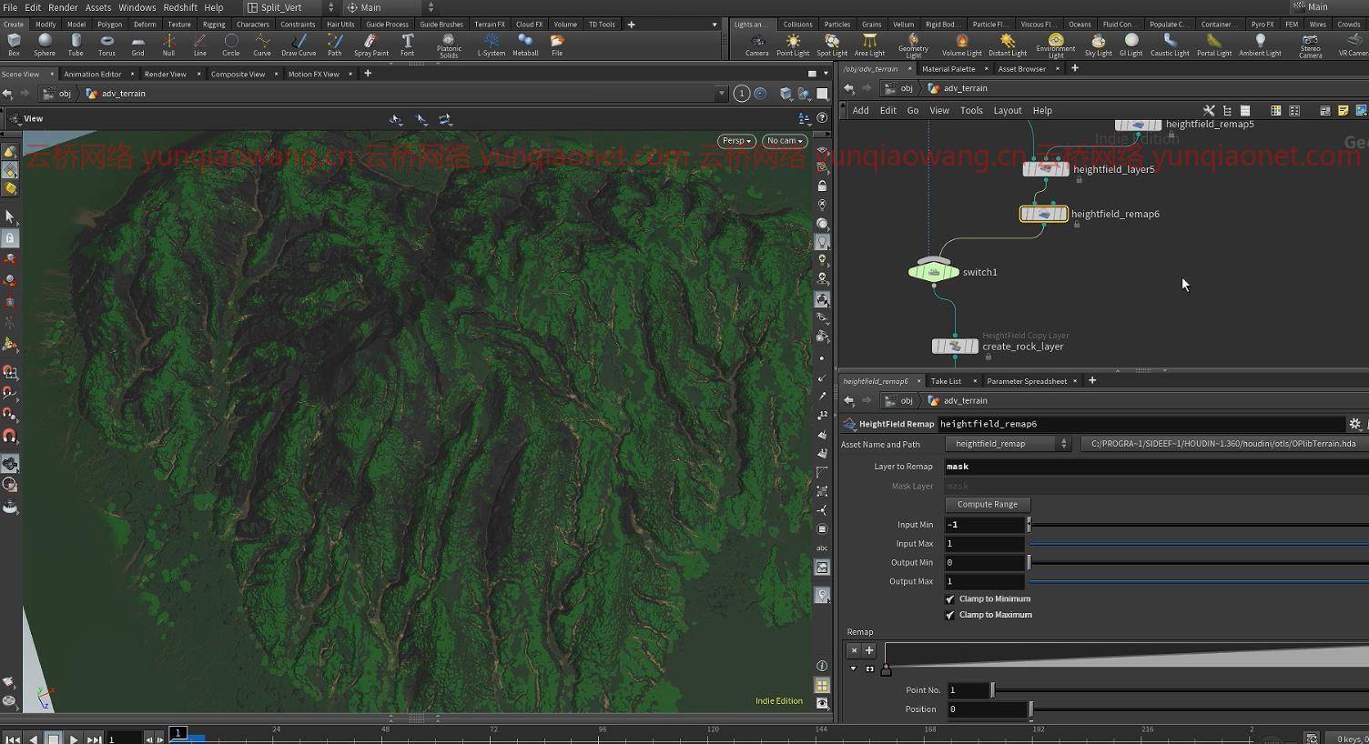
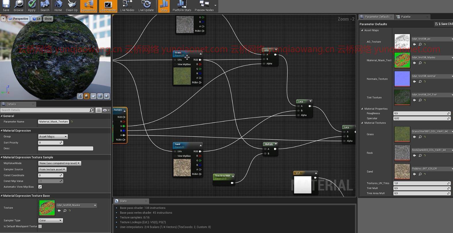
–将点云转换为具有多层信息的实际高度场,包括植被散射遮罩。
–使用烘焙地图将其转换为游戏资产
CGCircuit–Houdini使用卫星数据的地形
MP4 1920×1080 |总时间:4h 42m |大小解压后:9.22G|包含项目文件 语言:英语
CGCircuit – Terrains using Satellite Data in Houdini
本课程是为中级用户设计的,他们对Houdini有很好的了解,最好是看过《Houdini游戏地形生成入门》课程的人。
在观看了这门课程后,人们可以期望能够使用真实世界的卫星数据,并将其与Houdini内部的先进地形技术相结合,以生成令人惊叹的景观。
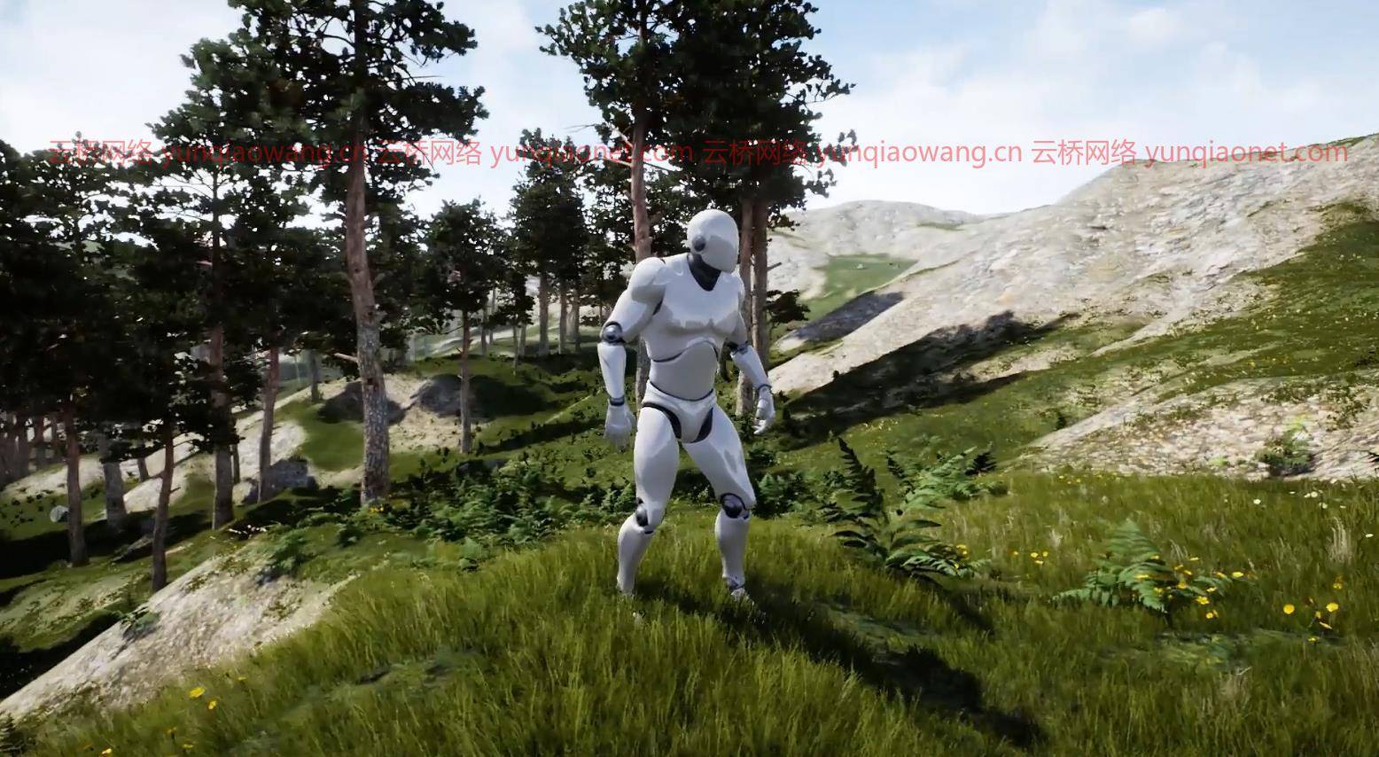
尽管本课程侧重于游戏引擎应用,但这些技术也可以应用于VFX的环境创建。
MP4 1920×1080 | Total time: 4h 42m | ENG | Project Files Included
In this online course, the viewer will build upon the workflows of the first tutorial and learn advanced techniques for generating more complex terrains and landscapes with Houdini and to use them inside a game engine like Unreal Engine 4.
We will be focusing mostly on how to import and process satellite topography data to:
– Convert point clouds into actual height fields with multiple layers of information including vegetation scattering masks.
– Convert it into game assets with baked maps
This course has been designed for intermediate users who have a good knowledge of Houdini and ideally who have watched the Introduction to Terrain Generation for Games with Houdini course.
After viewing this course, people can expect to be able to use real world satellite data and combine it with advanced terrain techniques inside Houdini to generate amazing landscapes.
Even though this course focuses on game engine application, these techniques can also be applied in VFX for Environment creation.
1、登录后,打赏30元成为VIP会员,全站资源免费获取!
2、资源默认为百度网盘链接,请用浏览器打开输入提取码不要有多余空格,如无法获取 请联系微信 yunqiaonet 补发。
3、分卷压缩包资源 需全部下载后解压第一个压缩包即可,下载过程不要强制中断 建议用winrar解压或360解压缩软件解压!
4、云桥CG资源站所发布资源仅供用户自学自用,用户需以学习为目的,按需下载,严禁批量采集搬运共享资源等行为,望知悉!!!
5、云桥CG资源站,感谢您的赞赏与支持!平台所收取打赏费用仅作为平台服务器租赁及人员维护资金 费用不为素材本身费用,望理解知悉!


评论(8)
获取密码!!!!
感谢分享….
看着不错啊啊
厉害的资源啊,希望能值得票子
厉害的资源啊,希望能值得票子